
Module 5--Exploring and Manipulating Data
Well, I can guarantee that I am not quitting my day job. Though the lab started out easily, I got hung up on populating the dictionary. I probably spent 16 hours or more just one that one small step. After I finally figured out the issue, which was that by adding the update, get value statement for keys and values, and the key:value format statement within the for loop, everything printed out as required. I figured this out by commenting out lines of code and then adding new lines to see what happened. I eventually worked through the issues. Of course, viewing the student questions site on Canvas also assisted. Believe me, I contributed to the questions, but I also shared my solution.
The lab worked sequentially and built upon each step. Beginning with creating a new file geodatabase, I then assigned my feature classes to "fclist." I then copied these FCs to the new fGDB using a "for loop" (and also stripped out the .shp extension). Between each step, I learned how to add statements showing the date, time, and the amount of time the computer needed to complete the step. I also used "\n" to make sure lines were skipped for ease of viewing.
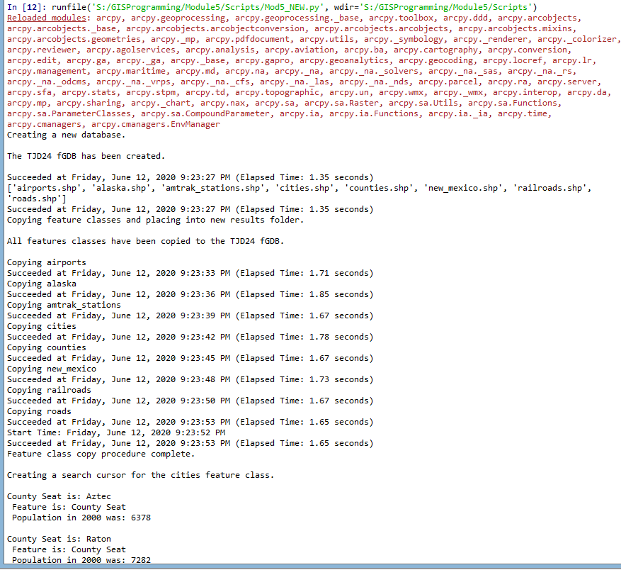 |
| This screenshot shows the first several steps of the lab, to include the commentary: Create fGDB, copy Feature Classes, and creating a search cursor that returns county seats. The list of county seats is truncated to save space, but the code shows the information for all the county seats. |
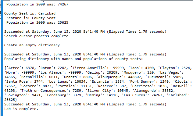 |
| Screenshot of the end of the county seat information. The dictionary is populated in the correct format {key:value}. Statements say how long it took, when the process finished, and the lab was complete. |
A few words of advice:
--delete the row and cursor once you complete a loop.
--use \n so there is a line break.
--use print(arpy.GetMessage(count-1)) to get the date/time/process time for each line.
--don't forget the # symbol to add a comment.
--make sure ArcGIS Pro is not running at the same time as Spyder or you will likely get an error message.
--use the overwrite argument to reduce the amount of errors you receive saying that the fGDB exists (env.overwriteOutput=True).
--comment out lines of code (sometimes I put different numbers of # marks to keep myself straight) and try new lines. This way, you don't make a change and forget how to reverse it.


No comments:
Post a Comment